")

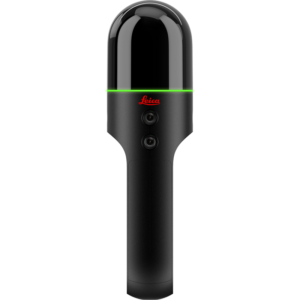
Leica BLKARC
Price on Application
Description
Autonomous Reality Capture for Robot Leica BLKARC
The Leica BLK ARC is an autonomous laser scanning module for robots. It is designed to be integrated with robotic carriers to enable autonomous mobile laser scanning with minimal or no human intervention. Users can simply plan a scan path and set BLK ARC off on its own to scan autonomously.
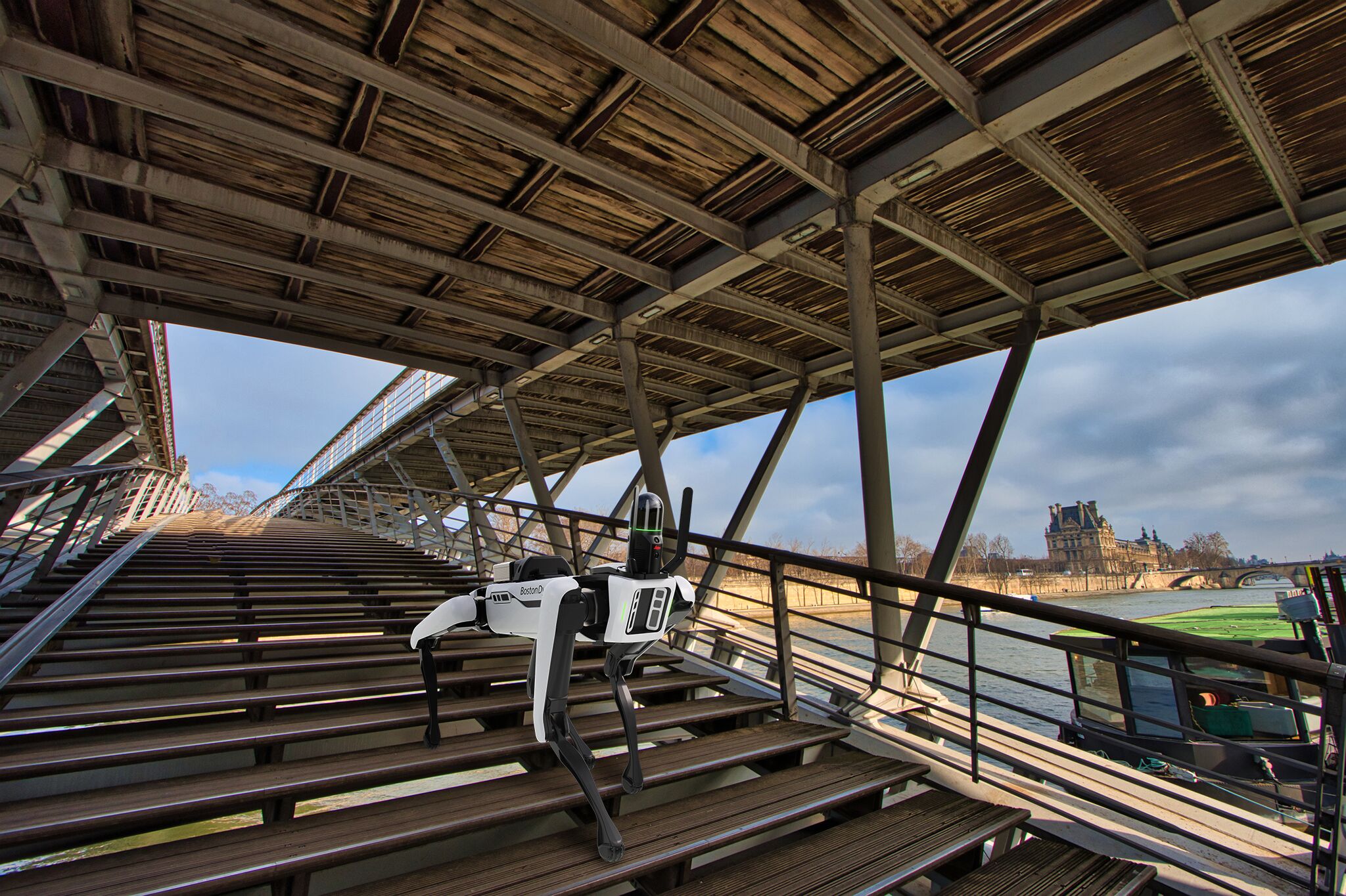
Our first robotic carrier is the Boston Dynamics Spot robot.
BLK ARC combined with Spot creates a fast, simple, safe, and autonomous reality capture workflow. Together, they deliver fully autonomous and repeatable scan missions to capture 3D point clouds and panoramic imagery while Spot carries BLK ARC through an environment.
Remote user operation
Plan and execute missions from a remote location, whether in the office or in the field, which also keeps you safe from hazardous areas.
Offline path planning
Create new missions and adjust existing missions for any environment using Leica Cyclone 3DR.
GrandSLAM technology
GrandSLAM combines LiDAR SLAM, Visual SLAM, and an IMU to enable fully autonomous scanning and robotic navigation.
Static and mobile scanning modes
BLK ARC can scan in static and mobile mode during the same scan mission and all scans of both types will be registered together during the mission.
LiDAR module protection
Included U-bar protects the BLK ARC module when mounted to its robotic carrier.
Simple user interface
Control and manage your BLK ARC from an easy-to-use, browser-based application: BLK ARC UI.
Upload to HxDR
Upload BLK ARC data directly from the module to HxDR, our cloud-based data storage, visualization, and collaboration platform.
Additional Information
BLK ARC UI enables the user to:
- Operate different sensors and robotic carriers
- Create user profiles
- Manage robot and scan settings
- Control robot trajectory and the detail camera
Features
- Performs scan missions autonomously with minimal user intervention
- Easily mounts to Boston Dynamics Spot and integrates with its sensors
- Improves robotic navigation while capturing 3D point clouds to create 3D digital twins
- Captures both static and mobile scans during the same scan mission
- Can repeat scan missions autonomously for up-to-date project progress and site changes
Have a question?
Speak to our specialist today.
Contact Us
Speak to our specialist today.
Related products
-
Leica BLK2GO
Price on Application -
Scan&Go Kit Easy Target
Price on Application -
BricsCAD®
Price on Application -
NEW Leica BLK360 Imaging Laser Scanner
Price on Application